Highway to Oaxaca Moving Along
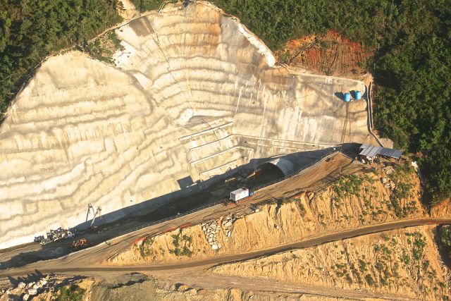
Photo: Roberto Cantón.
It’s all work, work, work, day and night as construction goes full tilt on the autopista to Oaxaca. The autopista is the 104 km toll road between Ventanilla and Barranca Larga, Ejutla. Ventanilla is just a few kilometers outside of Puerto Escondido. Ejutla is around an hour from Oaxaca. There is already a free highway connecting Ejutla to Oaxaca.
ICA, Mexico’s largest infrastructure developer was supposed to have completed the highway by the end of 2014. The actual projected date now is the end of 2015. From what we saw on a November 5 trip from Colotepec to San Pablo, Coatlán, this does not seem an unrealistic target.
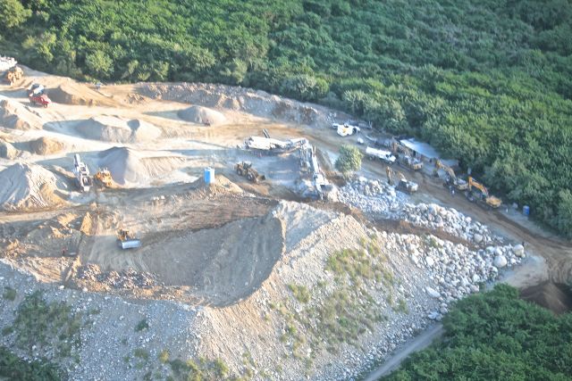
Photo: Roberto Cantón
As we reported in the November-December 2014 issue of the magazine, the span between Ventanilla and the Colotepec River just lacks asphalt and the completion of the Pita bridge. But don’t even think about checking it out for yourself; there are security guards to keep unauthorized vehicles out. (We traveled with authorization.)
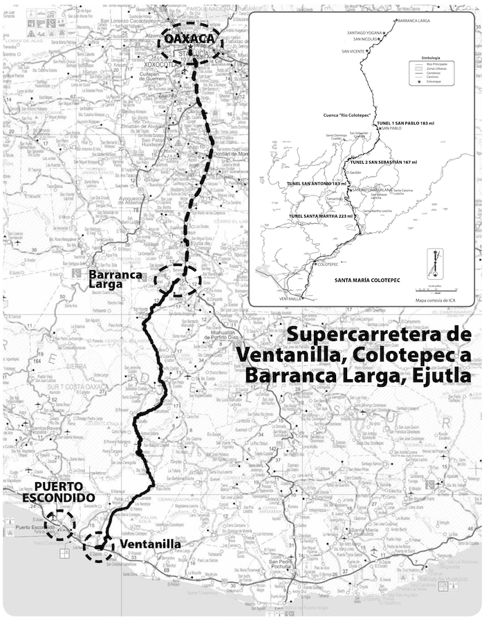
The bridge over the Colotepec River still has no roadway, but steel bars are lined up in the ready. Now the river is crossed by a packed-earth causeway. Section 2 covers the 20 kilometers of mountains on the west side of the Colotepec River extending to the end of the municipio and the Santa Martha tunnel. Most of this section has also been completed, except for the pavement.

Photo: Roberto Cantón
Section 3, from Santa Martha to San Antonio Lalana is part highway, part service road, but the road was so good that we actually missed the turn-off at the Lalana junction. In September we couldn’t drive past Lalana. Two kilometers north or the junction, we saw markings on a rock indicating where the second tunnel will be built.
In the rugged, pine-forested mountains of San Sebastian Coatlán in an area spanning 10 kilometers, however, no construction is being done. Here the builders are waiting for the State to resolve a border conflict between the communal land commissions of San Sebastián and San Francisco, San Pablo Coatlán. Historically, the mountains that separate these two communities formed a natural boundary between them. Too steep for farming or grazing, with no roads for extracting timber, the land only became valuable when the State bought it from San Sebastián for the highway. Since all parties are eager for the highway to be finished, it is expected that the State will provide a monetary solution that will satisfy both communities.
So at the dead center of the highway (around 52 km from either end) we had to take a detour over a service road that took us northwest of the highway to the town of San Sebastián Coatlán and then another road through the mountains to the San Pablo junction, 20 kilometers to the north. The detour added 90 minutes each way to our trip.
We could see the open road extending without obstruction all the way to Barranca Larga. Since we had already traveled on it from San Vicente Coatlán to its end last winter, see ¡Viva Puerto! #12, we took it on faith that one could easily drive the 35 kilometers from San Pablo to the highway’s end.

We had had lunch in San Sebastián, but I insisted we make a stop in San Pablo to visit the El Patrón Sports Bar. This establishment, owned by José Luis Mera and his family, is definitely the coolest spot along the route of the highway. Never mind that they won’t take my money and both times I’ve been there they insist on giving me a bottle of the local mescal. The thing is that José Luis spent 12 years in the U.S., speaks perfect English, and wanted to make a sports bar in his hometown. There’s just one small table, a half dozen stools at the bar and a karaoke machine. But besides beer and mescal, the bar offers a greater assortment of imported and domestic liquor than is found in most places in Puerto, not to mention the cocktails. And so with a reviving mescal and a cup of fresh made coffee, we headed back to Puerto.
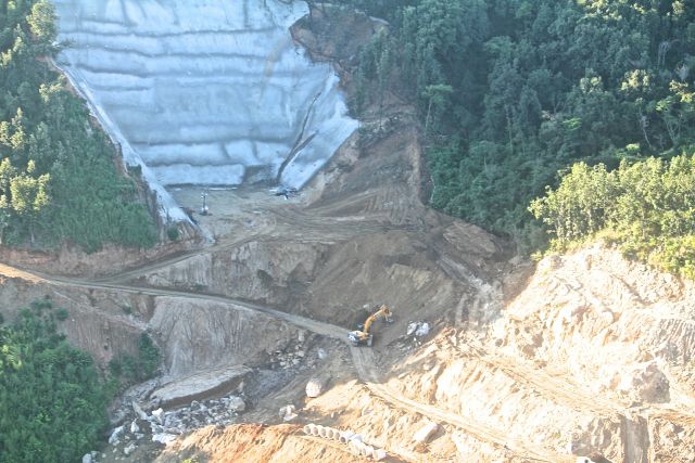
Photo: Roberto Cantón
The other highpoint of the trip was watching the Santa Martha tunnel being excavated. The inside of the mountain is dirt. I won’t go into the technical details, which I don’t understand, but an engineer on the site explained that dynamite would not be involved.
It took around two and a half hours to drive from the 155 km marker (100 is Barranca Larga, 204 is Ventanilla) to Puerto in the jeep. We will time it again in February.